Day 1 â Brush Prairie to Merrill Lake

John and I loaded up the car early in the morning and drove down to Olympia to pick up Larry. In Olympia we had a nice breakfast, stocked up on food, and drove a couple of hours south the start of our trip. The weather on the trip down was a little worrisome as clear skies would turn grey and rainy, then clear up again.
It took us a little while to unload the car and get the bikes together. We pedaled off at about 2:30pm. The route through Brush Prairie was nice but unremarkable. We passed through smaller and smaller towns until getting to the Gifford Pinchot National Forest boundary near Yale Lake. The rain was limited to drizzle on and off through the afternoon.

We turned up NF-81 to Merrill Lake. It wasnât too hot, but it was really humid and we all felt like we were swimming up the hill. Those 4 miles went slowly, but we finally arrived at the campground, got the last available site, ate dinner, and went to bed. On day one we established the phrase âthose last 4 milesâ meaning the last bit of the day when you think you are done, but there is really more work.
Day 2 â Merrill Lake to Curly Creek

I woke up a little before 6am to the sound of drizzle on the tent. It didnât sound too bad so I went and wandered around Merrill Lake Campground. The lake itself was really beautiful, but the campground showed signs of abuse and the downsides of having a campground with no trash pickup and no staff. There was quite a lot of trash around the lake and in the campsites. John and Larry woke up a couple of hours later just in time for the drizzle to stop. We ate breakfast, loaded up the bikes,and continued up NF-81.

My main memories of NF-81 are gun shots and wild blueberries. For some reason many people seem to come to this section of the forest for target practice. It left us feeling a little uneasy. On the bright side there were delicious wild blueberries along the road,little traffic, and the weather was improving.

We had been told about a washout around mile 11 and quickly found it. We took a break there to eat a second breakfast while we figured out a route around it. The road was rough and often covered in soft sand, but always passable. At the intersection with NF-83 we started the descent towards Ape Caves.
I had been to the caves before, but John and Larry had not. We didnât spend too much time there, but we explored enough to get a feel for them. I find the people watching around the caves to be very interesting.

The rest of our riding for the afternoon was along Swift Reservoir. There is a gentle descent along NF-90 and moderate traffic in this section so we formed a paceline and made very good time. At the end of Swift Reservoir we started climbing up NF-90 towards Curly Creek. The maps were particularly bad in this section, but our GPS hinted that there might have been a campground here. With a little hunting we found the entrance to it and had a prime campsite up from the creek and away from the road. After some exploring on foot and a nice dinner we headed into bed.
Day 3 â Curly Creek to Lake Takhlakh


In the morning we washed clothing and filtered water from Curly Creek. The section of it behind the old campground isreally interesting.The bed of the stream has a lot of lava which has been carvedby the water. Closer to the road the whole stream is made of this rock, and farther downstream there are large lava boulders.
Some of Larryâs friends had recently spent time at Lake Takhlakh and he was impressed by the photos. We decided to make it our destination for the evening.

In my mind Day 3 is really when the Gifford Pinchot started to show off itâs magic. NF-90 was a paved road with rolling hills until Lower Falls Basin. After that we had a gradual but steady climb up to the intersection with NF-23. There was almost no traffic (especially after the Lower Falls Basin) and the forest and scenery were stunning. John and I kept declaring it perhaps the best touring road ever. It really feels magical when you can ride three abreast on paved roads with no signs of civilization besides the bikes and pavement beneath you.
NF-90 ends near Mt Adams at the intersection with NF-23. We turned left towards Lake Takhlakh onto the dirt NF-23. During the climb we had read many signs saying that NF-23 was closed due to a washout, but we figured that we could get across it on the bikes. A couple of miles down the road we found the washout and it was bigger than any of us had expected. We turned back to find another place to camp and then decided that we should give it a try. It took about 30 minutes and a lot of teamwork, but we got our gear across the washout and were on our way.
The rest of the road up to Lake Takhlakh was loose dirt and it was hot, so it was slow going. We pulled into the campground around dinner time, found a nice campsite next to the lake, and setup camp. It started to rain after dinner and we went to bed.
Day 4 â Lake Takhlakh to the Pacific Crest Trail

The rain was constant overnight and I didnât sleep that well. I woke up early and walked down to the lake to see if I could catch a glimpse of Mt Adams. Just as I got there the clouds were blowing off and I watched a wonderful and dynamic sunrise over the mountain that literally changed minute by minute. I ran down to the day-use part of the lake to get an even better view. The show ended as quickly as it started â the sun started to heat up the lake and a fog formed which lasted about 45 minutes. That burned off and we were left with a clear blue sky and a different but still nice view of the mountain.

I spent some time studying my GPS and found an alternative way down that didnât involve crossing over the washout. The road that made this possible was un-named, and in the past weâve had bad luck with poor forest maps. We decided to give it a shot anyway and trusted the GPS. We did make one wrong turn, but then managed to find our road. It was an abandoned narrow logging road and had a steep and twisty descent back to Boulder Creek on NF-90 (where we ate the day before). I had a couple of mishaps â a flat tire and then leaving my camera on the side of the trail (I did go back and find it). Despite those problems it was a fun diversion to our other riding.

We had to climb back up the last few miles of NF-90 to the NF-23 junction and took a right this time instead of going left. The road rolled along the ridgeline for a few miles and then started a descent down to the town of Trout Lake. The top of the descent was fast and we had clear views of Mt Adams to our left the whole time. The middle flattened out a bit, then we were given a twisty/swoopy descent through the woods all the way to Trout Lake.
At Trout Lake we had a major decision to make. Our original plan was to ride down to the Columbia River and take the Historic Columbia River Highway west back to our starting point. When studying the maps we found that we could stay inside the forest instead. This was an appealing option give how great the riding had been so far, but we were fairly low on food since hadnât passed a store since the start of our trip. We filled up on lunch at the café in Trout Lake, found enough food at the general store to make it for another couple of days, and decided to skip the busy river and stick with the forest.
The ride out of Trout Lake was hot and slow. We all ate too much at the café and werenât running at 100%. It was weird to be back among cars again after two days of no traffic. Even relatively flat roads seemed to go on forever.

Things got better around the time that the traffic disappeared and we ended up back on National Forest roads. We were still poking along but made it to Goose Lake campground. It didnât look that great, so we pushed on to our next option, just marked as âCrestâ on our maps. It turned out to be where the Pacific Crest Trail crossed the forest road. The bad part was that it didnât have any water. I explored and couldnât find any, but we took inventory and decided that weâd have enough for the night. John and I also had a few beers that we had picked up in Trout Lake.
An hour after setting up camp a PCT thru-hiker showed up named Sara. She asked if we had found water because her map indicated that the closest reliable stream was 10 miles away. We gave her some water, some of our extra food, and talked about our trips. Sarah still had 3 miles to walk that day, so we parted ways, finished our dinner, and went to bed.
Day 5 â Pacific Crest Trail to Brush Prairie
John and I woke up early and freezing. We were jumping around camp wearing all of our clothing (literally) and trying to decide if we should make a fire. Larryâs smarter head prevailed and thought maybe we should just get on the road. We quickly packed up and got on the bikes.
Our goal for the morning was to make it down to the Wind River road. There were two ways of getting there and they looked fairly similar on our map. We decided to base it on how they looked at the intersection. Two miles down a dirt road we reached the intersection of NF-60 and NF-65. 60 was ascending and dirt, 65 was descending and paved. We took NF-65.

The descent down NF-65 is probably the best that Iâve done in my life. The road has one lane (âbike scaleâ as Larry called it) and was well paved and it seemed to go downhill forever. It had tons of curves. There was not a single car. We averaged 26 miles per hour for about half an hour hardly pedaling. John and I raced through the curves and Larry watched from behind, later commenting that it was like watching the motorcycles racing in Tron. At the bottom we found a great empty campsite (a couple of miles from the campground), ate breakfast, and filtered water.
Getting onto Wind River Road was a bit of culture shock again because it was two lanes and we saw one or two cars a minute. We rode a couple of miles up a gentle hill to a general store. We had two road options and were trying to decide which one was better. John asked the store owner and he told us that both were awful, rough, steep roads. We took the one that was a little longer but had more pavement at the beginning.

The climbing started pretty quickly after getting onto Soda Springs Road. The first part of the climb was paved and not too bad. However it was hot and we were going through water at an alarming rate and saw a lot of dry stream beds. We reached the turnoff for NF-42 and saw a work truck, but they didnât have any surplus water. We started up the road hoping to find some and lucked upon Trout Creek. We filled our bottles and carried 2 liters surplus in a water bladder.

From Trout Creek the road turned noticeably uphill. It was hot, the road was narrow, rocky, and steep, and we plugged along. It is the type of hill that you need to zen out on to really appreciate it. You canât pay attention to every foot or pedal stroke or corner, you just look around and watch it go by. This was a long, slow, steady climb.
Near the top the trees thinned out and we got a couple of small views of Mt Hood. Then the trees dropped away completely and we could see down into the valleys below. The road was lined with wildflowers, there were butterflies following us, and around every corner there were new stunning views. In one short period we could see Mt Hood, Mt Adams, and Mt St Helens. At the top the GPS read 3950â, not bad since we had started the climb at about 750â. I donât think that it possible to explain the high of getting to the top of the world after a long and difficult climb, but anyone who has done it will understand. Iâve done it before, but itâs never been as rewarding as this one.

The descent dropped those same 3200â on similar rocky, dirt, roads. It was a game of picking the right line and keeping it. I had a sidewall cut halfway down, but quickly put in a fresh tube and tire and we were on the way. Descending on this stuff is challenging (physically and mentally), but enjoyable. Once again we didnât see any cars or signs of human life except for the road itself.
We reached Sunset Campground at 4pm. It didnât look very exciting to me and we only had 25 miles left in our trip. I suggested that we eat and just ride straight to the car instead of camping. We ate almost all of the remaining food in a huge feast and plugged along. We were all tired and slow on the climbs, but on an amazing high from the riding earlier in the day. At 7pm after 70 miles and thousands of feet of climbing we got back to the car, loaded it up, and headed back home.
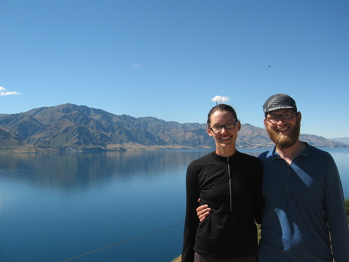
Photos
The Route

We parked at a house in Brush Prairie, WA. The instructions here are from nearby Battle Ground State Park.
- 182nd North to 279th
- Left on Heisson Road
- Right on Lucia Falls Road
- Pass through Moulton
- Take Railroad NE into Yacolt
- Take Amboy Road into Amboy
- Get on 503 N and take that to the intersection of 503 and 503 Spur (on most maps this looks like a 3 way intersection with 503) near Yale.
- Take 503 east to the turnoff for NF-81
- Ride 4 miles up to NF-81. We camped at Merrill Lake
- Follow NF-81 and NF-83 around to NF-90 (503 is renamed NF-90 at the forest border). Stop at Ape Caves if you are so inclined.
- Follow NF-90 along Swift Reservoir. There is a tiny general store at the end of Swift Reservoir, but we didnât find much there. We camped near the intersection of NF-90 and NF-51 by Curly Creek.
- Follow NF-90 to the end where it intersects with NF-23. Turn left onto the gravel NF-23 and follow it and NF-2329 to Lake Takhlakh. We camped here.
- Take NF-23 and NF-2334 back to Council Lake. There is an un-named road on many maps which connects Council Lake back to NF-90 near Boulder Creek. Take this.
- On NF-90 go uphill again to the NF-23 intersection and take a right this time. Follow NF-23 all the way down to Trout Lake.
- Restock in Trout Lake.
- Take 141/Carson-Guler Road to NF-65. You can camp along the way at Goose Campground or Crest Campground. The later has no water, so stock up at Goose campground. Crest Campground is free and quieter.
- At the 4 way intersection with Carson-Guler Road and NF-65 take the right onto NF-65. Follow it downhill until Wind River Road. There are tons of great camping options along here.
- Turn right onto Wind River Road. Stock up and read the map at Stabler.
- Take Little Soda Springs Road to NF-42.
- Follow NF-42 to Sunset Campground. Stock up on water at Trout Creek just before the major climb. This section isnât that long, but there is significant climbing and the descent is technical. Youâll need time to appreciate the views at the top.
- NF-42 turns into Sunset Falls Road which turns into Lucia Falls Road. You can then take Hession and 182nd back to the start.
I’ve loaded a GPX file with the route into Bikely.
This route took us 5 days with the longest day being about 70 miles and the shortest being about 35. On paper the route is about 215 miles, but you need to give yourself time for crossing washouts and the steep climbs. There are few places to buy food (all are noted above) so you should carry a 3-4 day supply.
We used the map Washingtonâs Cascade Mountains by Great Pacific Recreation & Travel Maps. This map didnât really have the detail that we needed in many areas, and we filled that in with a handheld mapping GPS. Iâd recommend picking up a more detailed map of the Gifford Pinchot and if you have a mapping GPS you’ll find it helpful.
Gear and Logistics
Most of our route was paved, but we did ride about 30-40 miles on gravel roads. All three of us had tires that were about 35mm wide and used touring bicycles with drop handlebars. Make sure that your panniers can be well secured to the rack and wonât come off from repeated vibration.
There are few locations to pick up food on the route, and none have a lot of variety. We each started out with a 4-5 day supply of food and supplemented this at two general stores.
Camping is easy to find and you can easily ride this whole route without staying in a fee-based campground.
Water is fairly easy to find, but youâll need a filter or other form of treatment. Most of the fee-based campgrounds didnât even have drinking water.
I don’t think that any of the campgrounds have electricity. Bring enough batteries for your camera and GPS.
Conclusion
I really donât know how to explain how unique and wonderful this route is. There are few options to spend this much time away from civilization while being on paved and gravel roads and with such wonderful scenery. It is close to Portland and Seattle. The popular routes in this area (such as North Cascades Highway in Washington) have much more traffic (but more services). If you really want to get away by bicycle I think that this is one of the best options in the region.


