Archive for the ‘Hiking’ Category.

Velkommen til Nordmarka

I’m in Oslo, Norway for work again and have a couple of days to myself.  My plan today was to rent a mountain bike, but by the time I found the rental place they were closed.  My GPS showed tons of trails in the area though, so I just started walking.

I quickly came to a sign that said “Velkommen til Nordmarka.”  Awesome, that was my backup plan anyway!  Nordmarka just means “north woods” and is a huge forested area in the northern part of Oslo.  This isn’t something small like Central Park in NYC, or Fairmount Park in Philadelphia, the Nordmarka just keeps on going and going and going (click the map and zoom out to see).  The coolest thing is that I got there by taking the T-bane (aka, the subway).

I looked at the map and started hiking towards the closest lake, figuring it might be pretty.  Once I was there I picked out another lake and hiked to there.  By the 3rd lake I figured I had a theme going and mapped out a sequence of lakes that would take me back to a different T-bane station on a different line.  The whole walk was about 18km (a bit over 11 miles) and I barely saw anyone, while hiking inside the city limits!

I’ve often dreamt of living in a city where one could take public transit to wilderness, spend the day or a weekend there (camping is allowed and popular in the Nordmarka) and easily get back home.  The closest thing that I’ve found was Wellington, NZ, but Oslo has it beat.

Sadly I left my camera’s battery in my hotel room, so you just get cell phone pictures.

The Hollemkollen ski jump, where I started my walk.

My first lake stop.

A fairly typical "blue" trail. Blue trails are summer only hiking trails. Red and brown trails are year round and more like tiny gravel roads.

Second lake

This is a ski cabin in the winter, a hiking cabin in the summer. You can stay there for a small fee and with nothing more than a sleep sheet.

The trails were very well signed. Sadly I find it very hard to keep Norwegian names straight in my head, so the signs were often confusing to me. I'm getting better at it though.

Third or Fourth Lake (on the hike), I lost count. The hike finished with three in fairly quick succession. The first of them had another set of cabins at it.

Whenever I thought things were getting a bit quiet there would be a babbling creek to keep me company.

The forest was beautiful and made me want to throw up a hammock and take a nap. Sadly my camping hammock was back in Seattle.

A bit of a view over the trees as I get towards the end of the hike.

This final lake was right next to the T-bane station and seemed to be the local equivalent of Seattle's Green Lake. There were many people out and enjoying the sun.

My route.

A week in Mazama

Our summer vacation this year was sort of 3 vacations right after each other. You’ve heard about the two smaller ones, our 3 day weekend on Lopez Island celebrating our 9th wedding anniversary and the 3 day Bumbershoot Festival. The highlight of my summer vacation time off started right after Bumbershoot when we rented a house in Mazama, WA for a week.

Mazama is the first town that you get to when crossing the North Cascades Highway from west to east. It is about 15 miles from Washington Pass and is surrounded by National Forest, National Park, and Wilderness. The town itself is tiny and basically consists of a general store (but the best general store that I’ve ever been to), a post office, a climbing guide service, and a couple of hotel/inns. We stayed about a mile out of the core town in a nice rental house that overlooked this big alfalfa field:

It was a great vantage point from which to watch birds, deer, and sunsets.

Rising up to the north of our house (just barely north) was “Goat Wall”. This is a cliff which climbs really steeply and then turns into Goat Mountain, with Goat Peak at the top of it.

One of the great things about Mazama is that it is the western end of the Methow Valley Sport Trail Association trails. This is a set of cross country skiing, walking,and cycling trails that criss cross the Methow Valley,and they went right by the door of our rental house. We used them every day to get to the Mazama Store or to the river and often just for walks or relaxing bike rides. The roads were nice too, but the trails were great.

A highlight on our second day was when we were walking along the trails and saw 3 black bears (two cubs and their mother). We kept a safe distance and watched them for a minute before retreating back to the road. I only had a small P&S camera in my pocket, so the photos aren’t great, but here are the bears:

Look closely at this one and you'll see 3 black bears. One (the mama) standing up, a cub just beneath her and in the tree on the right closer to the foreground is a second cub.  (Christine's notes)

The trails were really well built and had some cool features such as this suspension bridge over the Methow:

The big attraction of the trip for me was all of the nearby hiking and mountain biking. I brought up my new (to me) Rocky Mountain Hammer mountain bike, my IvyCycles with knobby tires, and our tandem. On most days I went for a mountain bike ride in the morning and a hike in the afternoon. It was great to be near so many great trails without needing to drive much.

There were two hikes that were real highlights for me. Sadly we forgot the camera on the first one, but it was a hike that started at Hart’s Pass and went out to Grasshopper Pass. The whole time you are hiking on a ridge line with fantastic views down into the valleys on either side. There were fires in some of these about 5 years ago and it was interesting to see the patterns of what the fires got and what they didn’t. The wildflowers were out (even this late in the year) and it really felt like we were on top of everything.

The other great hike was up to Blue Lake just past Washington Pass. I did this hike twice, once with Christine and again with our friends Larry and Kathy. It’s a quick hike (5 miles round trip, about 2.5 miles each way) with good views of the pass near the top and a stunning lake. I hiked it with Christine on a Saturday and the trail and lake were both quite busy. When I hiked it with Larry and Kathy we went on a Thursday morning and had the lake to ourselves for well over an hour.

The hike up to Goat Peak was also a good one, but challenging. I did this solo and early in the morning. The trail isn’t long (around 2 miles), but it climbs almost 2000′ in those two miles. It felt like I was walking up stairs for much of it. There is a fire lookout at the top, so I knew there would be good views. I wasn’t disappointed, but I think that the views from up by Hart’s Pass and Grasshopper Pass were even more stunning.

The mountain biking was also really good. I did a bunch of trips, some solo and some with friends. The first group of friends to visit us were Ben and Vanessa and their kids. Ben brought his mountain bike and we went riding up the West Fork Methow River trail. This was interesting because we could look down into this valley while driving up to Hart’s Pass, and it is one of the valleys that was in the fire 5 years ago. The underbrush was eating up it’s new found sunlight and was really thick. The trail is 8 miles out and back, and we went about 5 miles before turning around because the brush was too thick. The trail was the right mix of technical and fun, especially when coming back and riding it downhill. Sadly I seem to have mis-placed the memory card with the photos from that one.

Larry also brought his mountain bike when he visited and we went up to Sun Mountain Lodge. That is 15 miles away in Winthrop and is well known for it’s mountain biking. The trails up there were a little too easy (not very technical, ridden out as my friend Rory put it) but it was still a great day of riding bikes with Larry. I also forgot a camera (do you sense a theme?). We did a roughly 20 mile loop suggested by the bike shop in Winthrop which covered most of the trails. There was a lot of climbing in the middle and the ride ended on some nice downhill singletrack that was a lot of fun.

When we didn’t have friends visiting I still got some riding in. On my first morning in Mazama I headed up to Cedar Falls on my IvyCycles with slick tires. I just rode up to the falls and back, so it was mostly road riding on SR20 with a little trail riding at the end. The trail was a lot of fun though, and I wish I had gone back with the mountain bike and rode the whole thing. The falls were spectacular, but you can only see them from the top:

A couple of days later I tried to find singletrack in the Rendezvous Ski Trails. The roads that lead up there are easily accessible via the MVSTA trail system, so it seemed like the best option for a full dirt circuit from the rental house. There was a lot of climbing, some good views, cattle trying to block my way, but no singletrack. I asked later at the bike shop in Winthrop and they said that the Rendezvous area was better for XC skiing than cycling. It was still a nice loop for the morning, all on pretty good dirt roads. I would like to have more time to explore some of the side roads up there.

The final solo MTB ride that I did was up to Cutthroat Lake and back. This is the closest legal to bikes trail near Washington Pass. The lake wasn’t too spectacular, but the trail was good and there were a lot of good views.

All in all it was a good week of hiking, riding, and relaxing. I hope we can return again next year.

Full set of photos

Socked in at Vanson Lake

This past weekend Christine and I met our friends Nate and Sam for some camping and hiking near Mt St Helens. We met Friday night at a public campground with the goal of hiking Saturday up to Vanson Lake, camping there,and hiking around the area. On the map the area looked like it had many possibilties with many small lakes and potentially good views to the south and into the Mt St Helens crater.

The Vanson Lake Trailhead is a challenge to get to. You have to drive about 20 miles(over an hour)on logging roads, most of which are private and not very well mapped. Our guidebook had limited directions and the road numbers were often missing or disagreed with the numbers printed on our maps. Luckily I had a new GPS with detailed topo maps of the area and it helped out greatly. The most frustrating and also humorous part of getting lost on these logging roads was finding both sides of a locked gate — why lock the gate if both sides are freely accessible? One benefit of traversing this maze of logging roads was the promise of solitude, not many folks seemed to get this deep into the forest. This is unusual for an area just a couple of hours from both Seattle and Portland.

We got to the trailhead around 11:30 and started the hike in. The weather was chilly (around 45F)and damp, but there were hints that the clouds were lifting or burning off. The trail started in very nice forest, it appeared to be second growth but wasn’t too thick with underbrush. At about half a mile into the trail we started to see snow. I was expecting snow at some of the higher elevations (maybe near Vanson Peak), but it what remained appeared to be at the lower elevations.Luckily none of it was too deep and it was pretty easy to follow where the trail ran underneath it.

We pretty quickly reached Vanson Lake and found the best (and I think only) camping area. It was even chillier here than at the trailhead and damp, the clouds were just above us. The lake was small and beautiful. The camping area was next to one of the streams that feeds the lake and had three or four good tent spots and a couple of old fire rings. Christine and Sam were chilly, so we set up the tents so they could hang out in the warmth of their sleeping bags. Nate and I made some lunch and then hiked to the top of Vanson Peak (700 feet higher) to see if there were any signs of the clouds lifting. The trail up to Vanson Peak was nice with no snow (odd that the last snow was at lower elevation) and tons of wildflowers. Unfortunately the visibility was terrible. The trail sides were steep and dropped away quickly, it looked like there would be some wonderful views.

When we returned to the camp we found that the clouds were dropping and rolling in above the lake. It was incredibly beautiful, but not helping Sam and Christine get any warmer or lifting their spirits. We decided that the fog had won,so we packed up and hiked out.

On the way down the logging roads we looked for potential places to camp instead of going back to the campground. The best candidate was on an open bluff with nice views looking down to Riffe Lake. There was a stream to gather water from nearby,but it was covered in brush and completely inaccessible. So we ended up back at the campground, one spot over from the one we had stayed at on Friday.

It was a good weekend, even though it didn’t go as planned. There was a little disappointment at not actually camping at Vanson Lake and missing out on the great views that were hiding behind the clouds. On the other hand it was really fun to see Nate and Sam and to spend some time in the woods with them. I’d love to explore this area some more and even hike up there again. It area might be a good candidate for some weekend bicycle touring/exploration. The views from the the logging roads looking south to Mt St Helens reminded me of my bike tour in the region a year ago, just about 15 to 20 miles south of this point.

Hiking in Salt Lake City

After my couple of days in Spokane I visited Salt Lake City and Tuscarora, NV with my mom (who lives in DC). That was a great trip and I’ll write about Tuscarora in a future blog post.

I was more impressed with Salt Lake City than I expected to be. The city itself wasn’t too attractive to me, with huge superblocks downtown and a what seemed like car centric shopping areas that we farther than walking distance from most housing (even in the Sugar House District). It was flat and compact though, which would make it great for bike based life.

What I was really impressed with was the complete lack of suburbs because the city is literally right next to the mountains. In 10 minutes I could drive from the Sugar House District to Mill Creek Canyon (which appeared to offer the closest hiking)and get in a hike. My flight out was hours later than my mother’s, so on my last day I did exactly that.I bid farewell to my mom after breakfast and headed east towards the mountains. I parked the car around 10am.

Peek-a-boo views across Mill Creek from Thaynes Canyon with patches of snow in front.

I did a loop where I started going up Thaynes Canyon. The hike up was in moderately dense forest right up a canyon. Not much in the way of views, but lots of climbing and it felt good to be exerting myself after a few days in the car. When I hit snow (yes, I hiked to the snow line 15 minutes from downtown SLC in June) I turned around and took a spur trail trying to find better views.

Looking across Mill Creek to the other side.  Great views for 15 minutes from downtown SLC!

The spur that I found hit the jackpot. There were great views across Mill Canyon to the mountains on the other side. I hooked up with Desolation Trail and was able to take that all the way back to the car.

By 12:30 I was back in town eating lunch and enjoying a beer. At 2pm I was at the airport getting ready to fly back to Seattle.

I’m always jealous of my friends in Olympia and Spokane because they have great rural road cycling just minutes (by bicycle!) from their urban houses. Now I’m jealous of Salt Lake City for having great hiking and mountain biking so close into town as well.

Backpacking at Lena Lake

This weekend Christine and I hiked in the Olympic National Forest up to Lena Lake. Christine hadn’t been backpacking in 6 or 7 years and this is a great hike to get back into things with. It starts with a moderate climb that is a little boring, but once you get to the top the trail meanders through nice forest for a couple of miles before coming to the massive Lena Lake. There are tons of campsites around the lake so even on a busy weekend (and it was busy this weekend) you can find a secluded spot. We found one on the north end of the lake a bit up from the water and well out of earshot of our nearest neighbor.

We made one trip to Lena Lake before, in May 2000. It was very interesting for me to constrast the lake conditions. The lake has 2 major streams that feed it, both on the north end. In 2000 both of these streams were dry and I hiked a couple of miles up one into the Brothers Wilderness. This year they were both flowing fastand loud. The lake itself was flooded by around 3-5′ and many of the lakeside camp sites were flooded.

Christine had a great time and asked me to remind her how relaxing and fun hiking and camping are whenever she tries to think of excuses for not going. This is good news for me because I’m hoping to go on at least one backpacking trip and one overnight bike camping trip per month through September.

More photos…

Lightweight camping equipment — what a difference

Christine and I are going hiking this weekend to Lena Lake in the Olympic National Forest. It is a nice early season hike with good camping and nice hiking beyond the campground. Last time I really loved the contrast between the dry river bed and the mossy boulders. The old digital camera that took these photos doesn’t do it justice compared to the mental images in my head. Christine hasn’t gone backpacking in many years and this might have been our last backpacking destination 7 years ago. I’ve gone on and off over the last 10 years with other friends. I’m excited that the two of us are finally going backpacking again.

It’s interesting for me to compare the weight of our basic equipment and how it is has changed in those 7 years. I still do a good amount of bike touring and backpacking with friends and camparound 10 nights per year.In the past 5 years almost all of mygear has changed and I’ve bought it with an eye for lightweight and compactness. On our last trip to Lena Lake we used a Sierra Designs Alpha CD tent that weighed 9lbs with groundcloth, it has been replaced by a Tarptent Rainshadow II that weighs 3lbs with ground cloth. My old backpack (a huge Kelty internal frame model) weighed about 8lbs too and has been replaced by a Mountainsmith Ghost at under 3lbs. The sleeping pad weight is about the same, but a 1″ thick Thermarest has been replaced with a 2.5″ thick Exped Downmat. Our synthetic and bulky 3 or 4lb sleeping bags have been replaced with sub-2lb down bags.

As a result the weight of a my setup (backpack, tent, sleeping bag, pad) is 9lbs. In 2007 I think that same basic setup was over 20lbs. That is a significant difference. The weight isn’t the only difference, the volume of gear is smaller (mostly due to the lighter weight tent and down sleeping bag). In the photo at the right (taken at Lena Lake) my backpack towers up to my head — the smaller one barely reaches my shoulders.

Now I just need to avoid making up for it by carrying too much food and camera gear– my normal failures.

Oregon Coast Trip

Christine and I spent last week along the Oregon coast. We had originally planned to go to Jamaica for diving but changed our plans when Christine injured her ears (due to diving with an unknownsinus infection). They’ll heal but the doctor asked her not to fly for a couple of months.

We spent 5 days in Manzanita, OR (about 20 miles south of Cannon Beach and 20 miles north of Tillamook). The weather was so-so but we mentioned to get out for some good hikes on Wednesday and Thursday. I also went for a bike ride almost every day.

On Friday we drove out to Bend, OR and spent two days hanging out with our friends Nate and Sam. Saturday Nate, Christine and I went up to Mt Bachelor for a day of skiing (Christine) and snowboarding (Nate and I).

Some of the good photos follow. There are dozens more that you can view.

OnSunday wehead out from home tostay in a yurtat Fort StevensState Park. I had a lot of fun exploring the old fort. I think that it is incredibleand wonderful that these are left open for people to exploreinstead of boarded up and closed off from thepublic view.My favorite area wasRussell Battery which is getting mossy and green and whichwas completely deserted.

http://alexandchristine.smugmug.com/photos/137289705-M.jpg

On Tuesday we hiked the Cape Falcon Trail in Oswald West State Park. This was a great hike and since we were there in the off season we only saw a couple of other hikers. The hike goes along a bluff out to the end of the cape. You get great views of the Oswald West beach for the first half of the hike and then wonderful views of the rest of the coastline as you get out to the cape. The forest had early spring wildflowers (trillium mostly) and was very dense and lush from the rain:

Christine enjoying the view from the end of the cape:

and the view itself:

On Thursday we went to Hug Point just south of Cannon Beach and then to Ecola State Park just north of Cannon Beach. At Ecola State Park we hiked the somewhat new Clatsop Loop Trail. This is a 2 1/2 mile trail that climbs up through the forest, takes you to a nice view of a lighthouse, then drops back down closer to the coast, where you get the same view of the lighthouse. Christine and I were both disappointed in it, the Cape Falcon trail was much more scenic, less crowded, and much more enjoyable.

Hug Point was a really pretty beach and reminded me of Shi Shi Beach (although much less remote). It hada waterfall and a lot of interesting rock formations. Sadly we were there as the tide was coming in and couldn’t stay long (you can get trapped on certain parts of the beach). The tide pools also didn’t have very much wildlife at this time of year.

Here is the lighthouse that you see from the Clatsop loop trail:

Finally here are a couple of photos from our ski trip on Saturday. It was Christine’s first time back on skis in about 5 years and she did great. It was my only snowboarding trip this year and I did okay, but still lack confidence sometimes.

It was a great trip. We had never been to Bend and hadn’t been to the Oregon coast in 9 1/2 years. I don’t think we’ll wait that long to return to either area.

A long weekend around Mt St Helens

Last weekend Christine and I took a 3.5 day vacation away from Seattle. On Friday we drove down to Lake Trout, WA for a couple of days of camping and rafting to celebrate our friend Sam’s 30th birthday. We extended the trip until Monday to celebrate our 7th wedding anniversary.

The rafting was a ton of fun. We went over a 10 foot waterfall and hit a bunch of other Class II, III, and IV rapids. Our guide kept the flatwater part interesting by having Nate (Sam’s husband) guide the raft.


Another group goes over the 10 foot waterfall.


Nate takes over for our guide and leads us down the river. He made the boring flat part of the river more fun by making sure that we never went straight.

Sadly the goal was to suprise Sam for her 30th, but the Forest Service made this difficult. We were all going to meet at Atkisson Group Camp (aka Atkisson Sno-Park), but the Forest Service directions are very very wrong. Their directions say “Highway 141 north 15 miles to Forest Service Road 2400 (5 miles south of the town of Trout Lake). Turn northwest 3.5 miles to the Group Camp.”

At 15 miles on Highway 141 you are nowhere near National Forest and are in the middle of some rural housing. There are a lot of dirt driveways, but few have signs and none are marked as Forest Service Road 2400 and few even go northwest. All of the cars trying to get there drove up and down this stretch of 141 trying to find the camp.

It turns out that the camp is all the way at the end of Highway 141, near mile marker 29. It is on a road called Forest Service Road 011. Once we all found the camp (at about 9:30pm, 3 hours after the first folks were to arrive) we had a wonderful dinner of garden burgers and turkey burgers and chatted and watched the stars.

Saturday after the rafting we hung out at the group camp again and grilled up some Salmon and other fresh fish. Since this group camp is really a sno-park it had an abundance of asphalt and somehow we all ended up spending more time sitting on it than on the dirt.

It was a good time.

Sunday we said goodbye to everyone but Nate and Sam and headed west towards Mt St Helens. We took the slow and scenic route on the logging roads and stopped for a few great views:


Sam, Nate, Alex and Christine standing in front of Mt Adams


Mt St Helens (notice the missing top) from the south

Once at Mt St Helens we drove up to the Ape Caves. This is a roughly 2 mile long natural tunnel that was made with hot lava during an eruption 2000 years ago. You can walk the length of it accessing it from two different entrances. We didn’t really have the right footwear and lighting gear to walk the whole thing, so we explored it from both ends,starting with the top.


The upper entrance into Ape Caves


The ceiling had this strange silver reflective glow


A cavern illuminated only by the flashlights of other groups walking through


Returning to sunlight and warmth

After a few hours of exploring the caves we found a resturant for dinner and bid goodbye to Nate and Sam.

On Monday Christine and I celebrated our 7th wedding anniversary by going to Mt St Helens. We’ve lived in Seattle for 10 years and have never been to Mt St Helens. Sadly it was a little hazy that day,but it was still an incredible place to visit. The mountain errupted 26 years ago and foliage is just starting to come back. I imagine that the moon might look like this if life started to take over. Here are a few photographs from that day:


Fallen trees in the foreground with Mt St Helens in the background. These trees were blown over during the eruption.


Coldwater Lake was formed when falling chunks of Mt St Helens clogged up Coldwater Creek. It didn’t exist 27 years ago.


Life starts to return on Mt St Helens. You can see how brown the terrain is just in front of the mountain, but how green it is around the mountain. The lake is Casper Lake, which was created during an earlier eruption.

Mt St Helens was an incredible place. I hope that we don’t wait 10 years to return again.

There are many more photos. I hope you enjoy them.

Little Si Hike

On Wednesday my team at work took the day off and went hiking instead. We picked Little Mount Si (near North Bend), hiked to the top in time for lunch, headed back down and stopped for some ice cream. I love this sort of team building/morale event because it gives all of us a chance to talk about non-work stuff for the day. Other teams like to go to movies. They can be nice too, but don’t really give youa chance to get to know anyone better.

We had great weather for the hike. It was a little cloudy, but this kept the sun off of us and added a little drama to the scenery:

Here we are sitting at the top:

More photos can be found here: http://alexandchristine.smugmug.com/gallery/1783233

Shi Shi Beach hiking trip

Two weekends ago I went on a 3 day road and backpacking trip with my friend David. I’ve known him longer than anyone who isn’t a family member and we’ve been great friends for almost all of that time. He had some time off and we decided to do a trip together on the Olympic Peninsula. We try to do something like this every few years.

The weather was looking super iffy on the morning of June2nd and we spent most of it looking at weather reports and wondering if we shouldhead east (away from rain) instead of going west (into it). Finally we gave in and decided toignore the weather reports and head west. Like many great trips wekicked it off with a large meal and hit an Ethopian Resturant on the way out of town. During lunch the rain slowed down and things started to look better.

We had good ferry Karma and arrived at the Edmonds/Kingston ferry with no wait time for a ferry plus getting loaded onto one of thefirst lanes to be unloaded. The drive to Port Angeles was uneventful except forme making a wrongturn where we drove a 40 minute loop around the Port Gamble Indian Reservation (and yes, there is a casino in Port Gamble) beforepopping out exactly where we started and getting back on track.

In Port Angeles we arrived at the ranger station 2 minutes too late to get a bear canister, but the ranger told us we wouldn’t need one for our first night, andwe figured we wouldn’t have any food left by the second night.As the day turned into evening we realized that we had no flashlight and found aopen hardwarestore to buy one, then headed up into the park to go to Olympic Hot Springs.


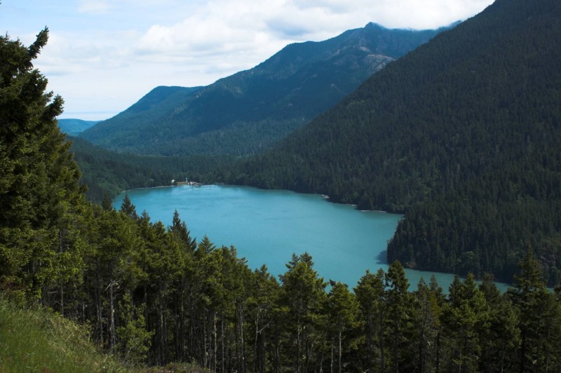
Passing Lake Mills on the way to the Hot Springs

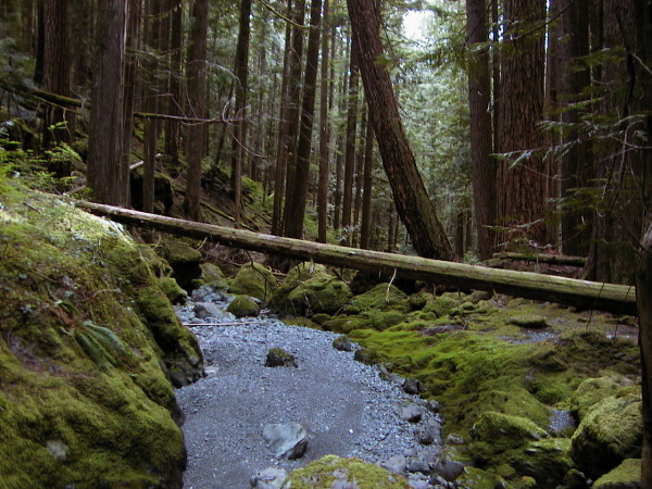
The trail into the Hot Springs was an old road so the hiking was super easy. We saw a few other groups coming out of the hot springs and an abandoned biking bottom of the side of the trail, but not much else on the hike in. We went to the campground first and setup our stuff, then went down and found the pools themselves.

The hotsprings were okay, but not great. They have higher algae growth than most springs that I’ve been too, and someone seems to think that using old car floor matts is an appropriate way to seal up the pools. I found it kind of disgusting, but I’ve also been spoiled by the wonderful hotsprings along highway 12 in the Idaho panhandle. David loves the springs and spent more time in them. We had some great conversations about how to best design a house that he is building and what the world will be like after peak oil.

While the hotsprings were lackluster the campground was great. It was mostly empty (only one other group was there), had bear wires for storing food, and the campsites were set pretty far apart and were flat. The only other people camping there were a little strange and very drunk and disappeared (while leaving their fire going) shortly after we got there. We shared a couple of beers and a little food and went to bed.

The next morning we headed out an on the road to Neah Bay to find Shi Shi beach.

Getting to Shi Shi beach is an adventure. It is a roughly 4 hour drive plus ferry ride from Seattle. In the last two hours of the drive (from Port Angeles) you’ll only pass through two communities before Neah Bay and both are very small with limited services. The scenery is nice though,and that is what really matters.

Once at Neah Bay you need to jump through a few hoops to get to Shi Shi beach. You need to pick up a Recreation Pass ($10) at one of a number of businesses in town. This pays for the trail to the beach. If you are with David you also need to find some fish for dinner. We asked around before finally being pointed to the fish processing dock and David walked down and was able to buy a full salmon,right off of the boat, for $5. $5, for a ~5lb fish. $1/lb for stuff that costs $20/lb back in Seattle. The day was looking up.

We arrived at the trailhead to discover a couple of rangers and a police officer looking at two trashed cars. They told us to park at the private parking lots (someone’s front lawn) a 1/2 mile back up the road. This cost another $10, but that is part of the Shi Shi adventure. You need to pay three people to get there — an Olympic National Park backcountry pass, the Makah Indian Reservation for trail work, and a private individual for parking so that your car isn’t broken into. Did we really want to go here that badly?

We did.


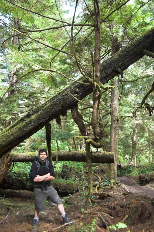
A cool tree along the Shi Shi beach trail

We loaded up our stuff and headed in. Since we didn’t have a bear canister we only brought food for that night and thought we’d find a nice breakfast in the morning elsewhere. The trail in started pretty nicely, it was mostly boardwalk and turnpike along some second and third growth forest. After about a mile it turned into a trek through the mud in second growth forest. The only people that we saw on the trail were a couple of rangers who passed us (going into the beach) and a odd woman walking very fast away from the beach who asked us if the wild raspberries were poisionous.

At the end of the trail we found a steep bluff down to the beach and the rangers were talking to a large group about their camping situation. We passed through and broke out of the woods onto the beach.


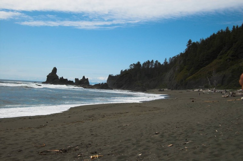
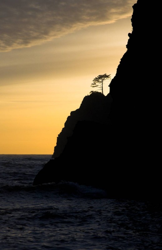
Shi Shi Beach, looking North

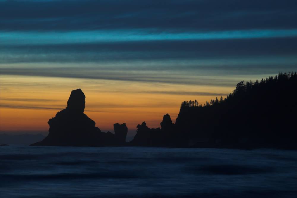
What a beach. There are large sea stacks at the points on either end of the beach. The beach is about 2 miles long and has streams coming across it in about 4 places. The stacks at the south of the of beach are called the Point of Arches and there are 3 arches that you can see through as you approach them.

We walked about half a mile down the beach, setup camp, and had some dinner. The fish was awesome:


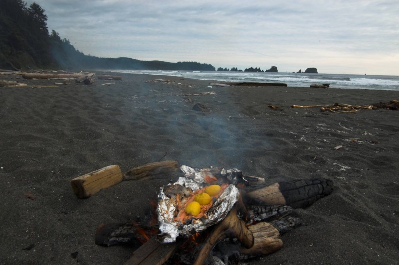
Grilling salmon in the fire

I’ve only recently started eating fish (after 15 years of being a strict lacto-ovo vegetarian) and this was the best that I’ve had so far. I expect that the setting, being hungry,and the freshness had a lot to do with that.

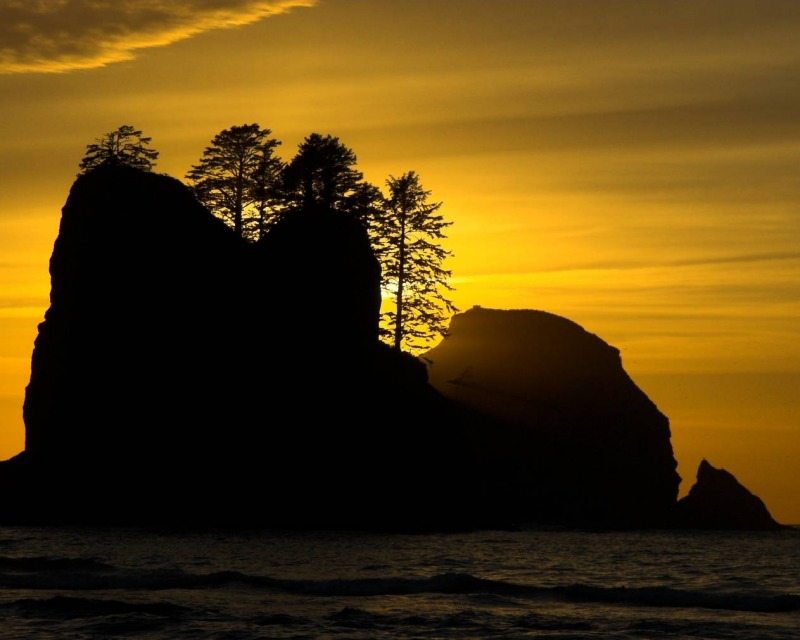
After eating about 2lbs of salmon and an ear of corn each we walked down to the end of the beach and back. The area around the Point of Arches was the most interesting and we waited there for sunset:


Sunset over the Point of Arches

Any thoughts of skipping this trip due to rain were clearly unfounded. The weather was wonderful and this might have been one of my more memorable sunsets (especially in Washington State). On the walk back up the sunset just got better and better.


We got back to our camp at dusk, restarted our fire, moved it a little bit closer to our sitting rock, and sat back and relaxed. What a wonderful weekend. I hope to make it back another time.


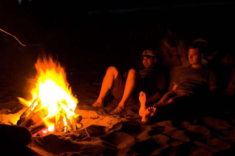
Relaxing by the fire

The rest of the photos.
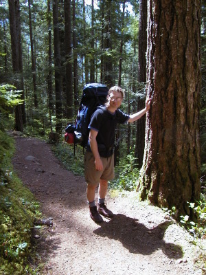