Jack Pass
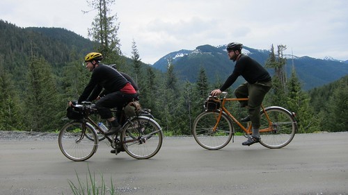
Jack Pass is north of Skykomish and east of Index. 10 years ago you could ride a nice loop between these three points, but now the road from Index to Jack Pass has been taken over by the Skykomish River. We parked at Beckler River Campground with a goal of seeing what laid on the other side of the pass, maybe going to check out what remains of Mineral City, explore future camping destinations and to see what the washouts really look like.
We planned this ride a few weeks ago, but the weather threw us a curve ball on Saturday afternoon. The forecast of high 60s and mostly sunny turned into 50s and heavy rain. I was ready to cancel when Rory wrote these words:
I say there’s 2 choices:
1. “remember that memorial day alex made us ride through that monsoon
on Jack pass?”
2. “Remember that memorial day we sat inside waiting for the rain to
stop?”
This is the stuff adventures are made of.
How can you say no to that? So on Sunday morning at 9am we all met at my house and drove up to Skykomish.
Mark had pointed out on the map that there were two ways up Jack Pass. Our plans were to take the left fork up the pass, then come back down on the main road. The plan started badly when I left our maps in the car. Thankfully I had my GPS, but scrolling around on the tiny GPS screen always takes a lot of time. We found the correct fork, and took it.
That ended pretty quickly at this washout, but we did find some future camping potential up there.


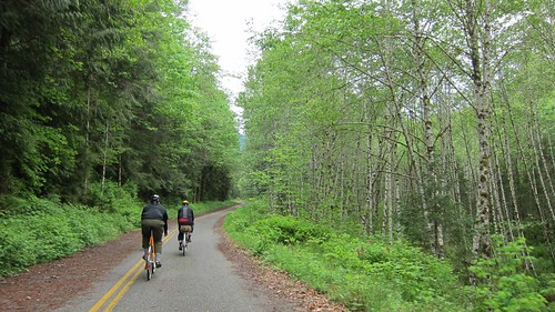
We backtracked and took the main road up Jack Pass. Going from South to North Jack Pass isn’t too steep and the climb went by pretty quickly. The scenery along the way was great, with small rushing down the mountain, and a few viewpoints with nice vistas to the right.


The descent down into the Galena valley was fast. Very fast. It felt like it only lasted for 5 minutes, although it probably was longer. At the bottom we found the one gate that we needed to cross that day,and this awesome waterfall. The gate was a good sign,gates mean almost no traffic.


Beyond the gate we found about 8 miles of old road which is hardly used anymore. Riding in this valley you can see that there is a constant battle between road builders and the river. It seems as though the river has won.
The road ends here. If you click on the image you can actually see some blacktop across the river. Lee, Mark and I took a short walk and explored that section of road, then found another washout. The next few photos show what we found over there.


The Rapha guys showed that one can get around this area if they are willing to wade. I wouldn’t mind trying that someday in the future and when the water is lower, but on this trip we decided that this was our turnaround point.
On the way back out we took the bridge over to Silver Creek to see what the trail was like up to Mineral City. Having left the maps in the car we didn’t have a good idea of how far we’d have to go. What we found was a rocky road with a stream running down the middle of it. 10 minutes of climbing up it was enough for us, and we turned around. I checked the maps later and it looks like we’d have to go up the road about 3 miles to find the ghost town. That would be a good side hike on a camping trip back in this valley.

I took this one last photo as we started up the ascent out of the valley:

Climbing up Jack Pass in this direction is much harder than it was in the other one. The roughly 1000′ elevation gain is about the same, but the road on this side is about half as long. I checked the elevation profile when I got home and it was about 2 miles of riding a 10% grade. All of our conversations disappeared as we each picked our own pace and made it to the top.
The ride from the pass back to the car was about 10 miles of downhill. It went quickly and enjoyably. We got to the cars having spent a wonderful day riding without rain, exploring new areas that I think we’ll all return to, and enjoying a nice day on the bikes.
As we were putting the bikes on the cars Mark ran into another SIR member who was camping there. We were just pulling out when he invited us back to his campsite to help eat leftover food. I don’t think 12 hot dogs have ever been consumed so quickly. It was a great finish to a long day.


mark mentioned hiking over one of the ridges to get to monte cristo. it looks like it’’s entirely possible by way of silver city. i see a trail that goes over poodle dog pass that decends into monte cristo. that could be pretty cool…
Great report – you spent the weekend well. Thanks for sharing it.
James Black
There are two washouts actually and you don”t have to wade. You can carry your bike around on a rough trail to the east on the hill side then ride for about 200 yards and then pack again. I came in from the Index road about 3 weeks ago. Road up to Galena and the sad Troublesome Creek campground. I was thinking it would make a nice low traffic loop.
Can you tell me what an SIR rider is? I looked at the acronym dictionary and found 82 possible uses, and some that might serve, but would love to know. Thanks
SIR is Seattle International Randoneeurs. It is a local cycling club which does brevet riding.
[...] [...]